
People started asking where their loved ones are buried, and the records were scattered. The parish needed an online search.
A parish was getting more and more questions about where their loved ones are buried, by phone and in person, and its cemetery records were scattered. I tried one idea: a search tool for families and visitors, plus an admin dashboard where staff update the records and the maps update with them. Designed for staff who aren't comfortable with computers.
Status: finishing up before launch. Names in the screenshots are blurred.
The starting point
People had started asking the parish where their loved ones are buried, some by phone and some by coming to the office. The cemetery’s records were scattered, and there was no online search. The parish looks after over two thousand records, so I wondered if one tool could do both jobs: help families and visitors find where someone is buried, and help the staff keep the records current and in one place. This is how I approached it with one parish, not the only way to do it.
Built for the people using it
The staff who run the cemetery are seniors, and most of them aren’t comfortable with computers. So I designed the dashboard and every feature around that: large, readable text, plain labels, and clearly named buttons like View map, Print and Save as PDF. If a step needed an explanation, I treated that as a design problem, not a training problem.
How I built it
I followed the same five steps I use on every project.
Empathize
I went to the parish office and watched how the staff actually work. I asked questions and learned their routine before I thought about any screen.
Define
I mapped out how the cemetery was being managed today, what wasn’t working, and what problems were likely to show up next.
Ideate
Three things became clear. First, this wasn’t only a search tool: the staff needed a dashboard to manage the records themselves. Second, it had to be as simple and obvious as possible for people who don’t use computers much. Third, the cemetery map had to update together with the data, so that staff only manage the records and the map follows.
Prototype and test
I used a platform that was already available and got the most out of what it offers. With AI as a tool, I built a prototype quickly, then tested how easy it was to use with the staff. I sorted the features worth adding from the ones nobody needed, and finalised the version we agreed on.
Implement
I built the agreed version, and it’s now in the final stretch before launch.
What it looks like
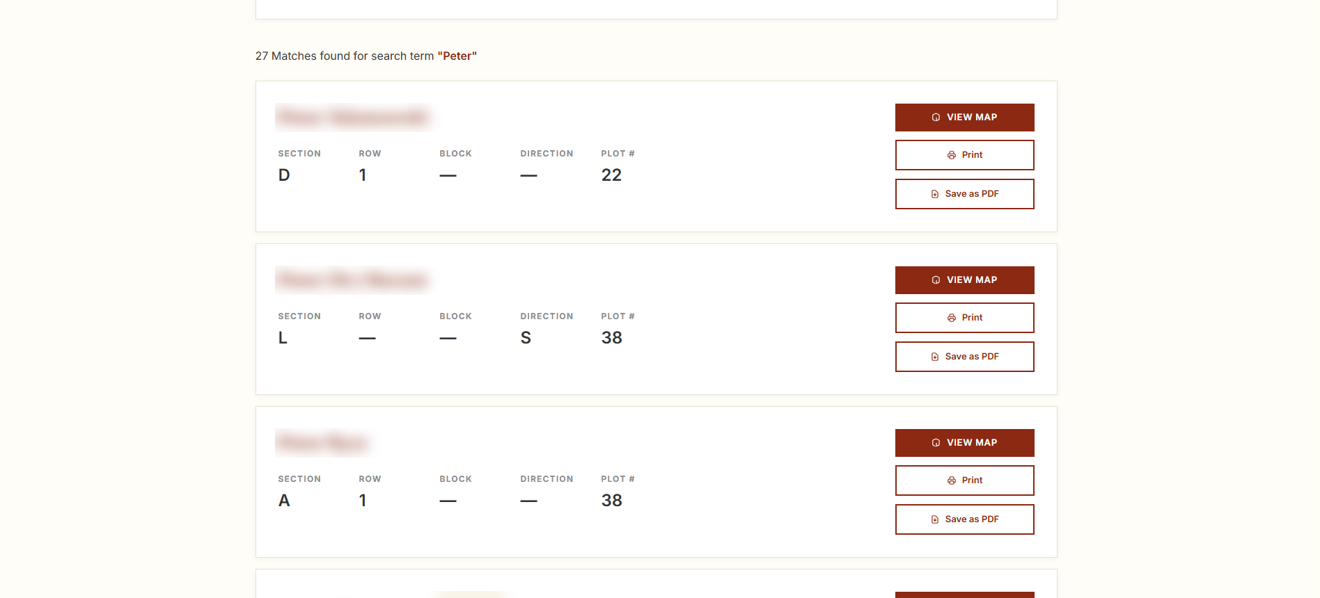
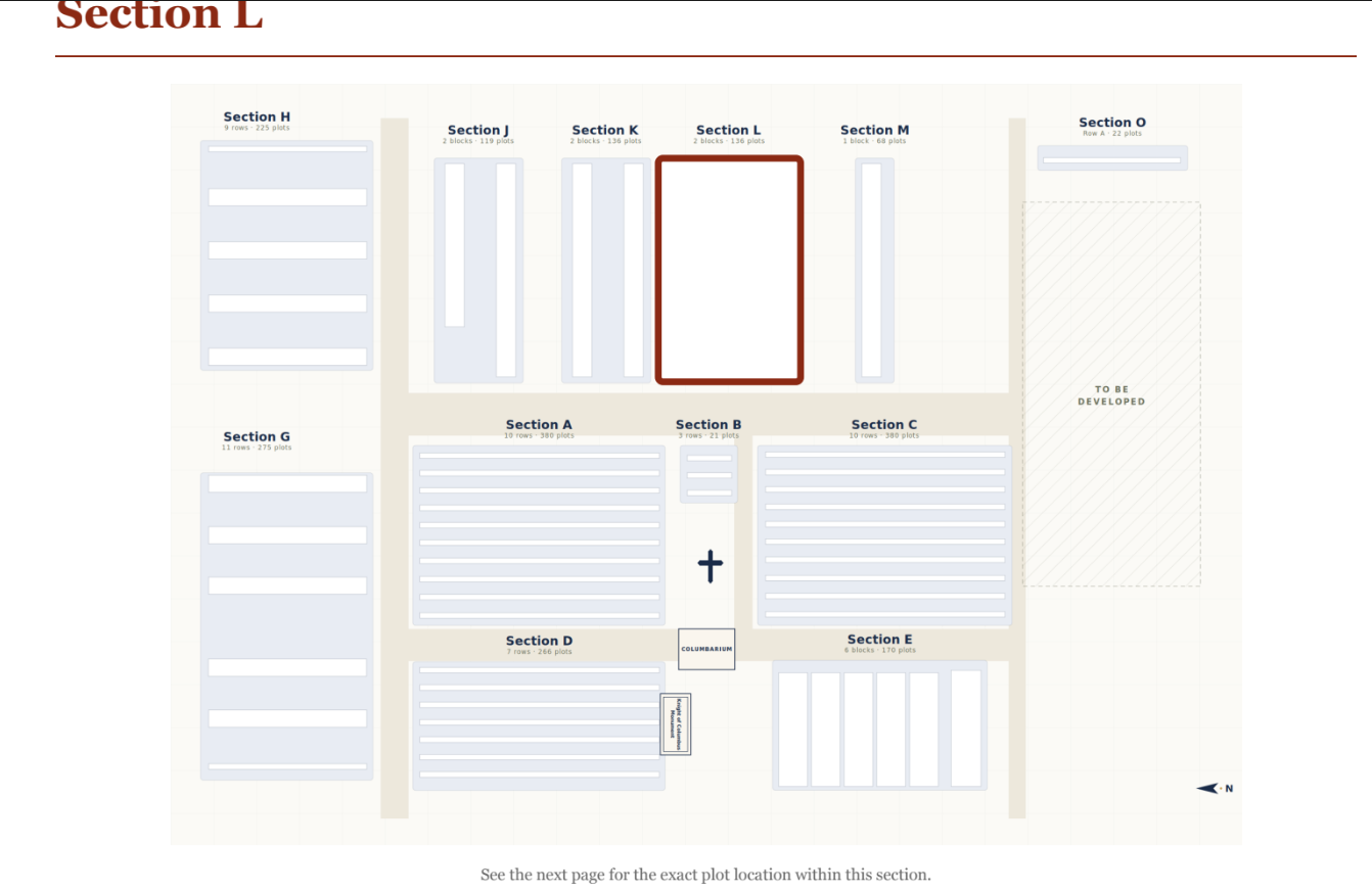
Finding the plot. Each search result shows the section, row, block, direction and plot number, with buttons to view the map, print, or save as a PDF. View map opens the section map with the right section highlighted, and the next page shows the exact plot.
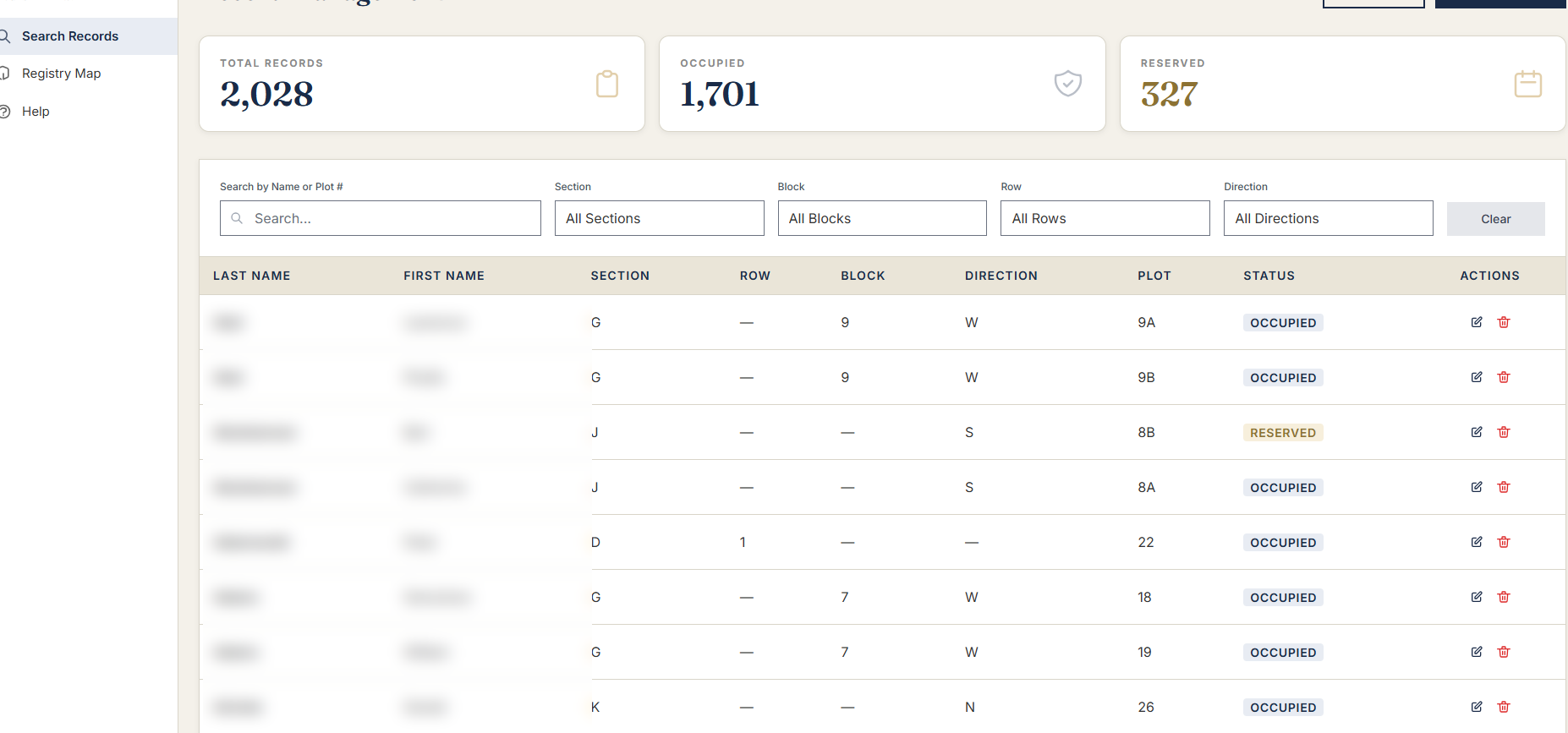
Keeping records up to date. Staff see the totals at a glance and can search or filter by name, section, block, row and direction. Each record shows its status, occupied or reserved, with simple edit and delete buttons.
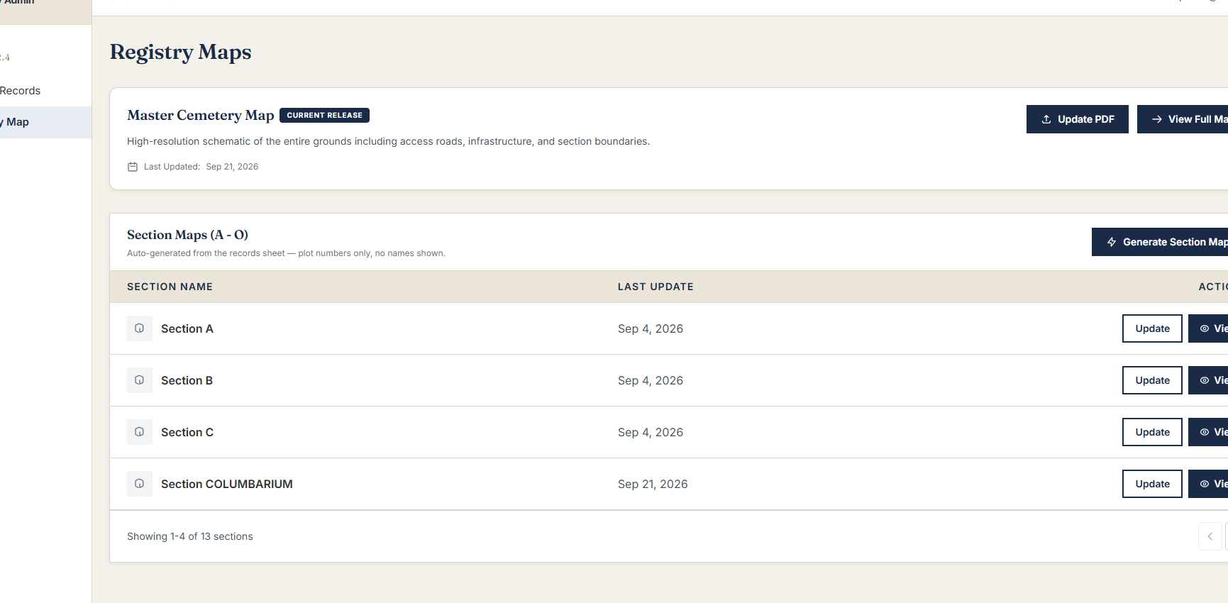
Keeping the maps up to date. The section maps are generated from the records sheet, so staff don’t redraw anything. One button updates a section, and another regenerates all of them. The maps show plot numbers only, no names.
Where it is now
The tool is built and tested with the staff, and it’s close to launch. I’ll update this page once it’s live.